Jersey City has a bunch of rail options, so you don’t really need a car to get around. The PATH train system connects straight to New York City, with stops at Journal Square, Grove Street, Exchange Place, Newport, and Hoboken. The PATH train network really holds Jersey City’s public transportation together, running 24/7 and giving you direct access to Manhattan.
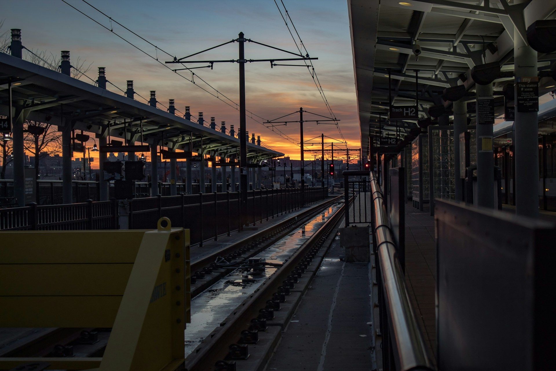
You’ll also find the Hudson-Bergen Light Rail running through Jersey City. It links Bayonne in the south to Hoboken and North Bergen. This light rail helps you move between neighborhoods and connects with other transit—think NJ Transit buses and, of course, the PATH.
Easy booking across hundreds of accommodations from luxury high-rises to unearthed brownstone treasures.
Browse Accommodations Now
If you’re planning a trip around Jersey City, these rail systems will save you both time and money. You can buy multi-trip passes for both, or just grab a SmartLink card for PATH trains. Most stations are clean and easy to navigate, and they include accessibility features for travelers with mobility needs.
Overview of Rail & Subway Systems in Jersey City
Jersey City has a pretty robust rail and subway setup, connecting you to the whole region. Getting around the city—or heading to places like New York City, Newark, or Hoboken—is straightforward.
Key Transportation Networks
PATH (Port Authority Trans-Hudson) is the main rapid transit system here. It runs all day, every day, and connects you to Manhattan and other New Jersey cities like Hoboken, Harrison, and Newark. Jersey City has four PATH stations: Exchange Place, Grove Street, Newport, and Journal Square.
NJ Transit’s Hudson-Bergen Light Rail brings modern, convenient service to Jersey City. It stops at places like Liberty State Park, Jersey Avenue, and Harsimus Cove.
You won’t find NJ Transit commuter rail stations directly in Jersey City, but it’s easy to reach them via PATH connections at Hoboken Terminal or Newark Penn Station. That opens up the rest of New Jersey for you.
Integration With Regional Transit
Jersey City’s transit systems work well with the broader regional network. You can use a SmartLink card or OMNY payment on PATH trains, so transferring between systems is pretty painless.
From Jersey City, you can get to New York City in about 10-15 minutes on PATH. The trains connect directly to major NYC subway lines at World Trade Center and 33rd Street.
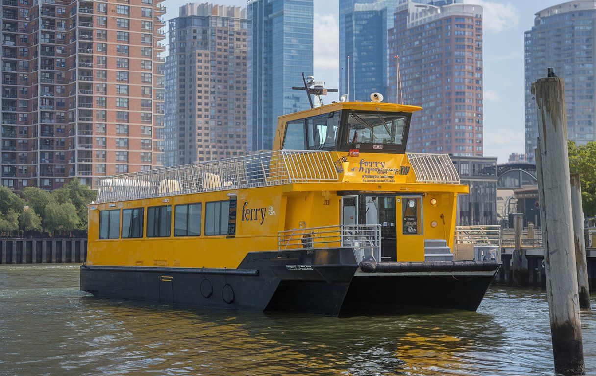
Ferry service adds another option, with boats leaving from Exchange Place and Paulus Hook to various spots in Manhattan. Riding the ferry gives you a more scenic commute than the subway.
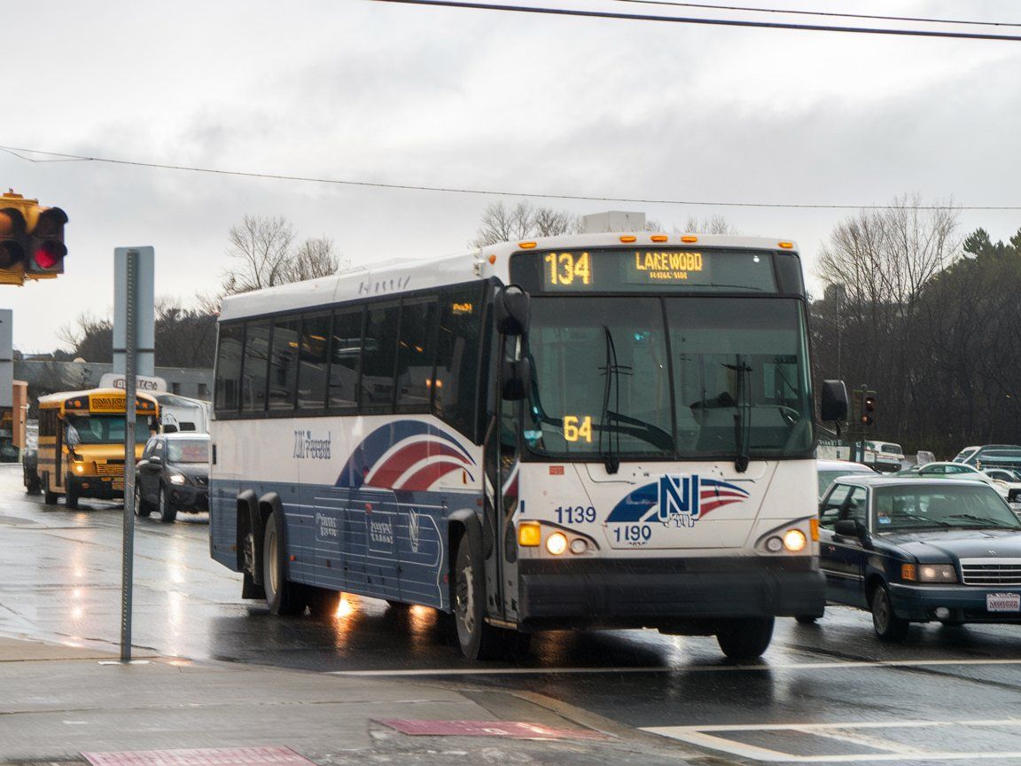
Bus routes in Jersey City link up with rail stations, so you get a full network. NJ Transit buses and private carriers like Coach USA serve areas not reached by rail.
PATH Train Service
The PATH train system connects Jersey City and New York City, running 24/7 all year. PATH (Port Authority Trans-Hudson) trains give commuters and visitors a reliable way to travel between New Jersey and Manhattan.
PATH Stations in Jersey City
Jersey City has several key PATH stations that plug you into the larger metro area. Exchange Place sits right in the financial district, with waterfront views and easy access to office buildings and restaurants.
Journal Square acts as a major transportation hub, with tons of bus connections and plenty of retail nearby. Grove Street sits in the downtown district, surrounded by shops, restaurants, and residential buildings—so it’s popular with commuters and folks just out for fun.
Newport station gets you to the Newport Centre Mall and the waterfront. Harrison station, recently updated and technically in Harrison, serves a lot of Jersey City’s southern residents.
Connective Routes to New York
PATH trains link Jersey City to several spots in New York City. The World Trade Center line runs from Exchange Place and Newport straight to Lower Manhattan, making it a quick commute to New York’s financial district—usually about 10 minutes.
The 33rd Street line connects Grove Street and Journal Square to Midtown Manhattan, with stops at Christopher Street, 9th Street, 14th Street, 23rd Street, and 33rd Street. This route is especially handy for getting to Chelsea, Greenwich Village, and Herald Square.
On weekdays, PATH trains run often—every 4-5 minutes during peak hours. On weekends, service is usually every 10-15 minutes, though sometimes there are schedule tweaks for maintenance.
Schedule and Accessibility
PATH trains run all day, every day, but the frequency changes depending on the time. During rush hours (7-10 AM and 4-7 PM), expect trains every 4-5 minutes. At other times, they usually come every 10-15 minutes.
You can check real-time PATH info with the RidePATH app or by calling the 24/7 info line at 800-234-PATH. All PATH stations have electronic boards showing arrivals and service updates.
Every PATH station is wheelchair accessible, with elevators, ramps, and spaces on trains for passengers with disabilities. You can bring bikes during non-peak hours, and the system is stroller- and luggage-friendly.
Fares are $2.75 per ride, with discounted multi-trip options via SmartLink cards or OMNY payment. PATH lets you transfer for free between its own lines, but not to the NYC subway or NJ Transit services.
Hudson-Bergen Light Rail
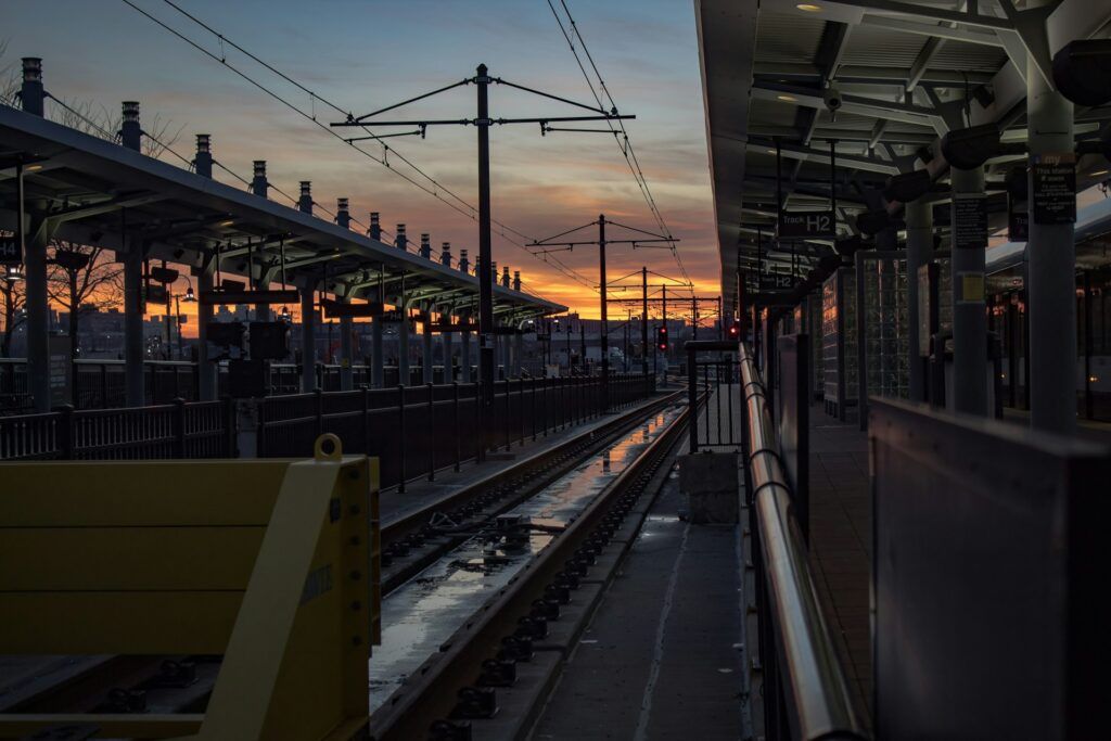
The Hudson-Bergen Light Rail (HBLR) links Jersey City with its neighbors, running along the Hudson River waterfront. NJ Transit operates it, and it’s a solid way to reach key destinations.
Major Stops in Jersey City
The HBLR stops at several important stations in Jersey City:
Find available hotels and vacation homes instantly. No fees, best rates guaranteed!
Check Availability Now
- Exchange Place: Major hub with Manhattan skyline views and PATH connections
- Newport: Access to Newport Centre Mall and waterfront homes
- Liberty State Park: Gateway to the park, outdoor fun, and ferries to Ellis Island and the Statue of Liberty
- Jersey Avenue: Connects to Bergen-Lafayette
- Garfield Avenue: Serves southern Jersey City
Each station has ticket machines, schedule info, and waiting areas. Most are ADA accessible with ramps or elevators.
Route Overview
The HBLR operates along three main routes on Jersey City’s east side:
- West Side Avenue Branch: Runs from West Side Avenue through Liberty State Park to Hoboken Terminal
- Tonnelle Avenue Branch: Connects Tonnelle Avenue to Hoboken Terminal
- 8th Street Branch: Goes from Hoboken to 8th Street in Bayonne
Trains usually come every 5-10 minutes during rush hour, and every 10-20 minutes at other times. The whole system covers about 17 miles with 24 stations.
You’ll get some nice Hudson River and Manhattan views along the way. The light rail runs daily from early morning until after midnight.
Transfers and Connections
The HBLR connects easily to other transit:
PATH Train Connections:
- Exchange Place
- Newport
- Hoboken Terminal
NJ Transit Rail Connections:
- Hoboken Terminal
Ferry Services:
- Liberty Landing Ferry (from Liberty State Park)
- NY Waterway (from Exchange Place and Hoboken Terminal)
You can use the same ticket to transfer within HBLR lines. For PATH or NJ Transit rail, you’ll need separate tickets.
Payment is flexible: cash, credit cards, and the NJ Transit mobile app all work for buying tickets. If you’re riding often, a daily or monthly pass might make sense.
New Jersey Transit Rail Lines
NJ Transit runs several rail lines connecting Jersey City with the rest of New Jersey and beyond. These lines are essential for commuters, visitors, and residents.
Key Lines Serving Jersey City
The Hudson-Bergen Light Rail is your main NJ Transit rail option in Jersey City, with stops like Exchange Place, Newport, and Hoboken Terminal.
From Hoboken Terminal, you can catch several NJ Transit commuter rail lines, including the Main Line, Bergen County Line, and Pascack Valley Line, all heading to northern New Jersey.
Jersey City also has PATH trains (not NJ Transit, but worth mentioning), which connect to Manhattan and Newark. If you want NJ Transit rail service to New York, you’ll usually transfer at Secaucus Junction or Hoboken.
Broad Street and Newark Connections
Newark Broad Street station acts as a big hub for NJ Transit rail lines. From Jersey City, you can reach Newark by taking the PATH to Newark Penn Station, then switching to NJ Transit at Broad Street via light rail or bus.
The Montclair-Boonton Line and Morris & Essex Lines both stop at Newark Broad Street, connecting to towns in Essex, Morris, and Passaic counties.
Newark Penn Station links up with the Northeast Corridor and North Jersey Coast Line, which go to Trenton—where you can transfer to SEPTA for Philly or Amtrak for longer trips.
Boonton Line and Beyond
The Boonton Line, part of the Montclair-Boonton Line, reaches many Passaic County towns like Little Falls and Wayne. To get there from Jersey City, take PATH to Hoboken, then switch to NJ Transit trains. It takes some planning, but it opens up a lot of destinations.
Beyond the Boonton Line, NJ Transit’s network covers the whole state. You can reach the Atlantic City Line in the south or the Raritan Valley Line in central Jersey by transferring at Newark Penn Station.
For trips to Paterson or other Passaic County spots, the Main Line runs directly from Hoboken Terminal. Expect about an hour from Jersey City to those areas.
River Line & Newark Light Rail
New Jersey’s light rail network helps you get between cities. The River Line and Newark Light Rail each serve commuters and tourists in different ways.
Access From Jersey City
To reach the Newark Light Rail from Jersey City, hop on PATH to Newark Penn Station. The light rail stops right there and covers downtown Newark and nearby suburbs.
There are two lines: the Newark City Subway and the Broad Street Extension. The trip from Jersey City to Newark Penn Station takes about 20 minutes on PATH, then you can transfer to the light rail.
Luxury stays to cozy apartments await, all with instant booking. Find the best deals!
Browse Jersey City Stays
Buy tickets at stations or on the NJ Transit app. A one-way ticket is cheaper than driving and dealing with parking in Newark.
Connections to Trenton and Camden
The River Line connects Trenton with Camden along a 34-mile route. You can’t access it directly from Jersey City, but you can get there by taking NJ Transit trains.
Here’s how to reach the River Line:
- Take PATH to Newark Penn Station
- Switch to a NJ Transit Northeast Corridor train to Trenton
- At Trenton, hop on the River Line
The River Line runs along the Delaware River, giving you some nice views. It stops in towns like Bordentown, Burlington, and Riverside between Trenton and Camden.
In Camden, you can check out waterfront attractions. The River Line runs daily, so it’s easy to plan day trips from Jersey City.
Ferry and Alternative Transit Connections
Jersey City also has several water-based transit options to go along with its rail network. These ferry services offer scenic routes to neighboring areas and help commuters skip the traffic.
Ferry Services Along the Delaware River
NY Waterway runs ferries between Jersey City’s Harborside Ferry Landing and downtown Manhattan’s Brookfield Place Terminal/Battery Park City. The ride zips you across the river in just 10-15 minutes, and honestly, the skyline views are tough to beat.
If you’ve ever been packed into a PATH train during rush hour, the ferry can feel like a breath of fresh air. You can buy tickets for single rides or grab a monthly pass, and regular commuters get some nice discounts. Most ferries have comfy seats and WiFi, and you might even find snacks or drinks onboard.
The Harborside terminal sits just a short walk from the Exchange Place PATH station, so getting there is a breeze. Ferries usually start running early in the morning and keep going until late evening on weekdays, though weekends run on a lighter schedule.
Connections to Staten Island and NY
From Jersey City, you can get to Staten Island and the rest of New York by using connected transit systems. There’s no direct ferry from Jersey City to Staten Island, but you can hop on the PATH to Manhattan and then transfer to the Staten Island Ferry at Whitehall Terminal.
The Staten Island Railway links up with the ferry terminal once you reach Staten Island, so you can keep exploring different neighborhoods. This network of services gives you plenty of ways to get around, whether you’re commuting or just out for a day trip.
NY Waterway also connects Jersey City to midtown Manhattan at West 39th Street. These routes come in handy if there’s a PATH service issue or if you just need to get to the west side of Manhattan quickly.
In the summer, they sometimes add special ferry services for events or leisure trips. Schedules can change with the seasons or for big events, so it’s a good idea to check ahead before you go.
Transit Maps and Resources
Trying to navigate Jersey City’s rail and subway lines gets a lot easier when you’ve got the right maps and apps. NJ Transit and PATH both offer resources to help you figure out the public transportation system.
Where to Find Updated Transit Maps
System maps help you spot all the transit options around Jersey City and nearby areas. You can pick up official maps at a few key spots:
- NJ Transit stations (look for printed maps near ticket counters)
- Customer service desks at major hubs
- Jersey City municipal buildings
- Jersey City’s transportation resources page
- PATH stations (check the wall-mounted maps)
These maps show how PATH trains, Hudson-Bergen Light Rail, and NJ Transit buses connect. Each one uses color-coding, so figuring out transfers and routes doesn’t take much effort. Transit agencies update these maps when services change, so grab the latest version if you can.
Digital and Mobile Transit Resources
These days, planning transit trips in Jersey City is way easier with digital tools:
NJ Transit’s app gives you:
- Real-time arrivals
- Service alerts
- Trip planning tools
- Mobile ticketing
PATH has its own app with train schedules, station updates, and fare details. Both apps send out notifications if there’s a service disruption.
Moovit is another solid option—it pulls together all the public transit maps for the New York-New Jersey area, covering buses, trains, subways, light rail, and ferries. You get step-by-step directions and arrival estimates.
Google Maps and Apple Maps both include Jersey City’s public transit schedules, so you can plan trips that mix walking and transit without much hassle.
Regional Connectivity and Future Developments
Jersey City’s rail network keeps growing, with new connections linking nearby cities and upgraded infrastructure on the way. Transit agencies have a few projects in the works to make trips between Jersey City, Newark, and New York City smoother.
Improvements in Rail Infrastructure
NJ Transit is busy upgrading several Jersey City stations to make them more accessible and comfortable. You’ll see platform renovations, brighter lighting, and new electronic displays popping up. Safety features and weather protection are getting better too.
PATH is modernizing its signal systems, which will let trains run more often. That should mean less waiting around during your commute.
A lot of stations now have easier transfers to buses and light rail. Free Wi-Fi is showing up at more major terminals, so you can stay connected while you travel.
Planned Expansions for Jersey City
There’s talk of an exciting circular rail project that could link Jersey City with Newark and a bunch of other big New Jersey cities. Imagine skipping New York City altogether and still having new travel options open up.
NJ Transit keeps looking into ways to stretch the Hudson-Bergen Light Rail into more corners of Jersey City. By bringing the system to new neighborhoods, they’ll finally connect some areas that always felt cut off from the main transit network.
Find the perfect hotel or vacation rental. Instant booking, no fees!
View Top Stays
Some planners want to make the ride to Philadelphia smoother and faster—maybe even cutting down that travel time quite a bit. If that ever happens, you’d suddenly have more job options and could actually consider a Philly day trip without a headache.
And let’s not forget: new express bus routes are in the works too. These should work alongside the rail system, giving you more choices and a bit of breathing room, no matter what time of day you’re traveling.

